
Friday, September 6th – 24 miles today/24 miles total
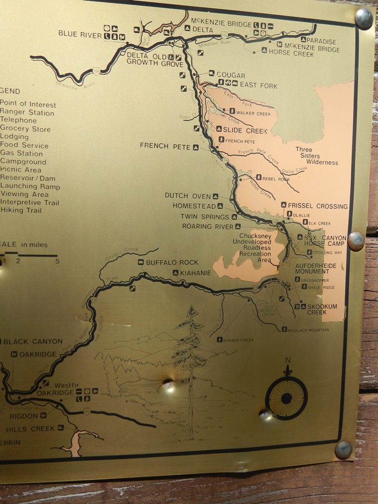
As our previous teaser post alluded to, our most recent trip was a wonderful loop within the Willamette National Forest, east of Eugene/Springfield from Rainbow to Westfir to Lowell and back to Rainbow. GPSies.com calculated 137 miles and a bit over 15,000 feet of climbing and descending.
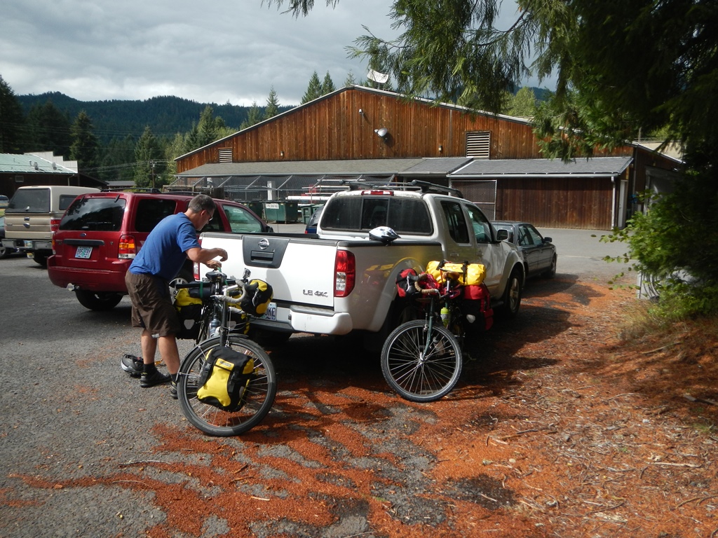
Loading up…
Since life seems to always happen, we completed the trip in our expected time frame, three days and two nights, but not in the way we’d planned. Who would ever think that would happen to the Peterbergers? Our plan was to leave the house on Friday around 8 am and be riding by 11. This would give us plenty of time for the 55 miles and climbing we’d scheduled for that day, leaving about 45 easy miles, or so, for Saturday and the remaining 40 miles and a big climb to finish on Sunday.

Ready to roll!
A Thursday call to the ranger station in McKenzie Bridge confirmed we could park in their overflow lot for the weekend but there was a big trail run on Saturday so there’d be a large number of people around. Since we’d be heading away from the highway at Rainbow, the ranger suggested we ask for permission to park in the lot behind Harbick’s Country Store in Rainbow/Blue River. This sounded great since they have a video monitored employee lot behind the store.

Slow for professional Hula Hoopers ahead
By 11 am, we were finally on the road. After a quick lunch stop outside of Salem, we made a beeline to our starting location and parked behind Harbick’s (Thanks guys!). We began pedaling about 2:40 pm, just possibly a new record, even for us! There was a nice 2 mile pedal on the back roads through Rainbow for us to reacquaint ourselves with riding with a load again.
On our way up and up
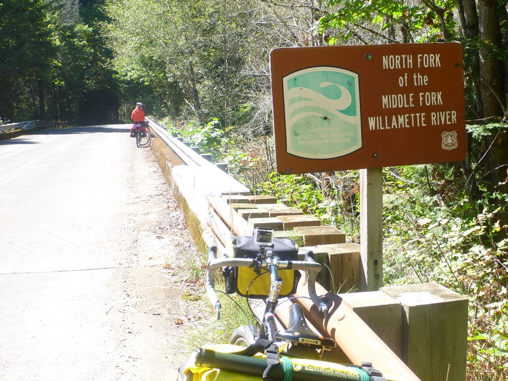
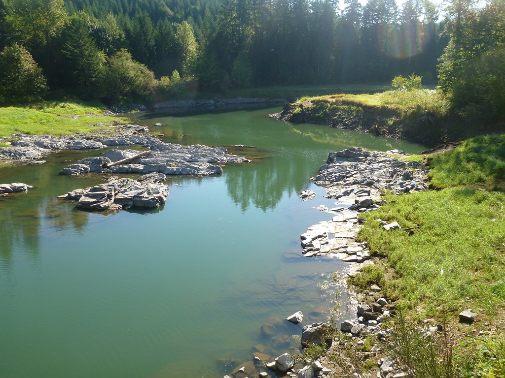
Connecting with Aufderheide Drive (NF 19), we started the steady climb to the rim of Cougar Dam nearly 500 feet higher and just over five miles total into the ride. According to the Army Corps of Engineers sign, Cougar Dam is the tallest rock dam in the state of Oregon. This time of year, the reservoir was quite low and there was no boat traffic at all.

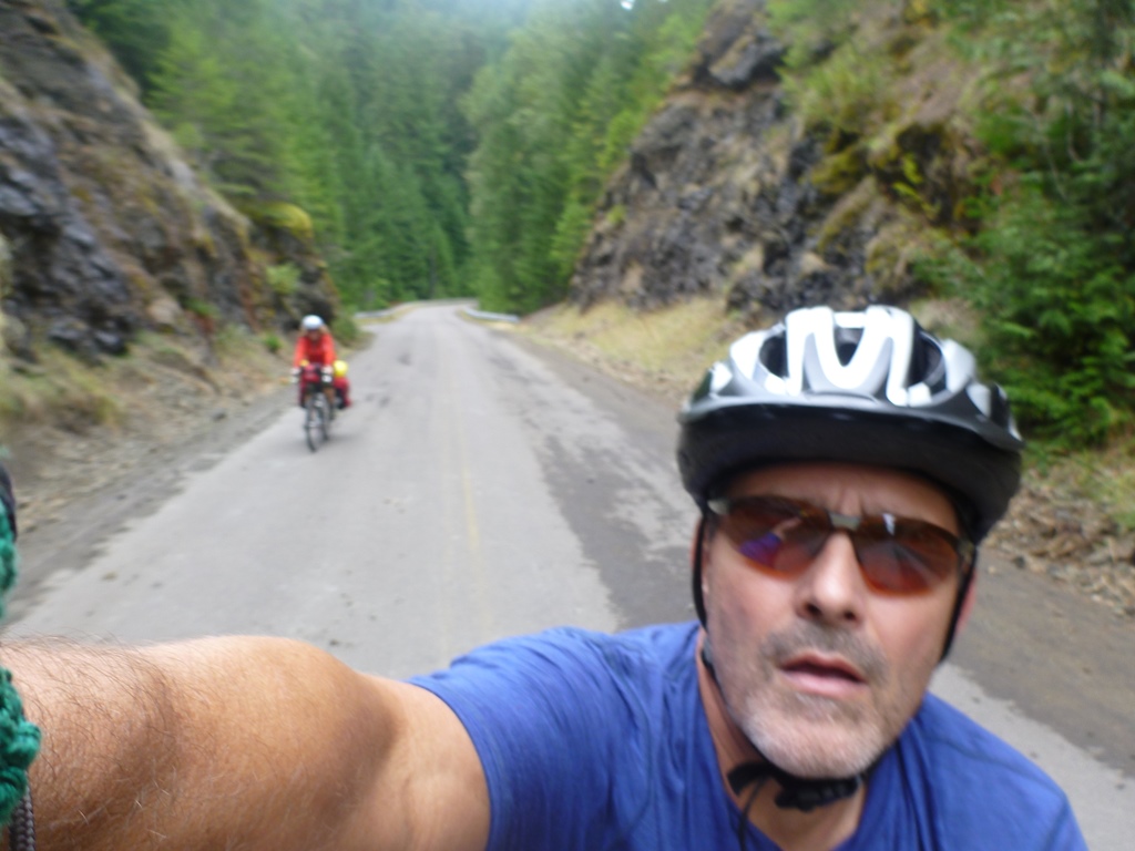
Aufderheide Memorial Drive was named in honor of Robert Aufderheide, former Supervisor of the Willamette National Forest, and is part of the West Cascades Scenic Byway. From start to finish, in either direction, this is one of the most scenic roads we’ve ever ridden. After passing Terwilliger Hot Springs about 9.5 miles in, we saw very little traffic until Sunday when we came out of the hills and back onto Hwy 126 for the last few miles back to the car.

Approaching Cougar Dam
The ride from either side is a constant, mild climb through dense forest until the final summit push, averaging about 8%. We’d been climbing steadily with the hope of crossing the summit and camping in the Willamette River watershed, south of the crest. But, as the light began to fade, we quickly realized our late start and slow pace made this option an unwise choice. Luckily there had been a string of Forest Service campgrounds along the road so we kept track of each as we pedaled onward.
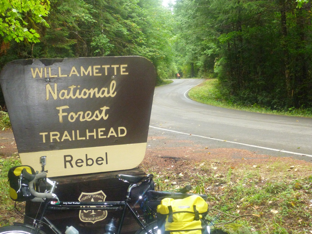
That’s us, Rebels…

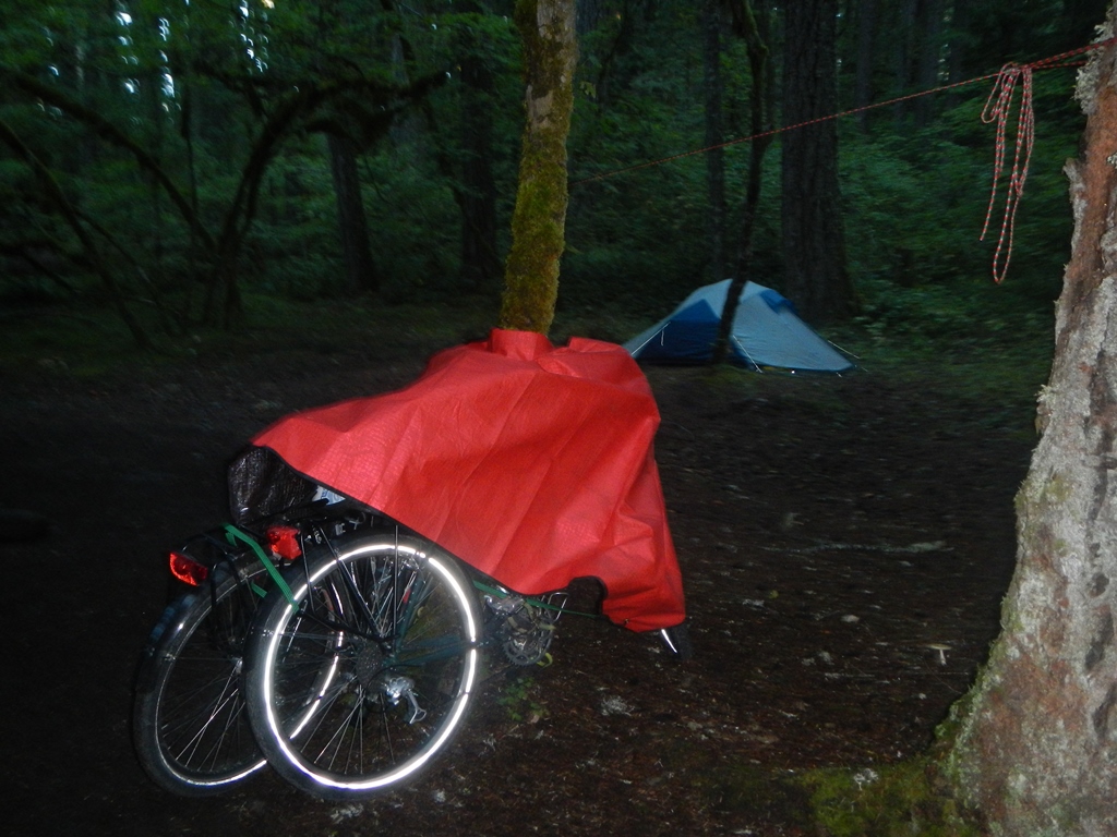
Home for the night!
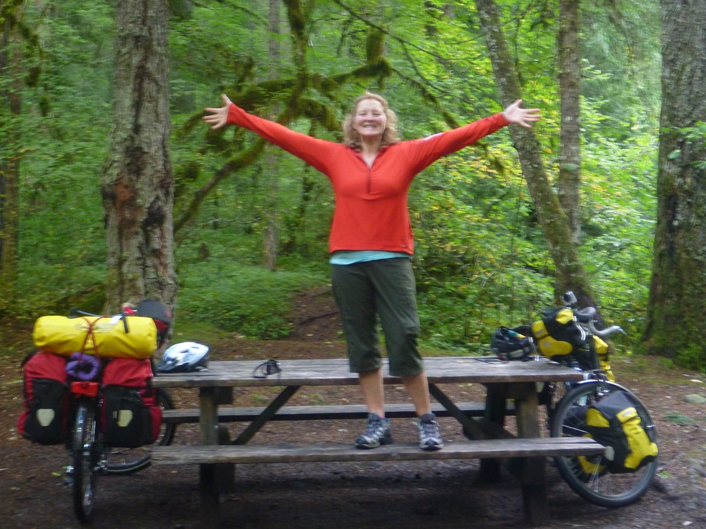
Queen of the Forest
As the light began to fade and change hues, we came across Frisell Crossing Campground, completing a whopping 24 miles and 3400 feet of climbing, and found a wonderful and nearly empty campsite along a fast flowing creek. The campground had a water pump, a pair of vault toilets and, most importantly, the quiet of a forest empty of any human noise. Our only company was a woman, her corgi and the two older black labs they were dog sitting for the long weekend.
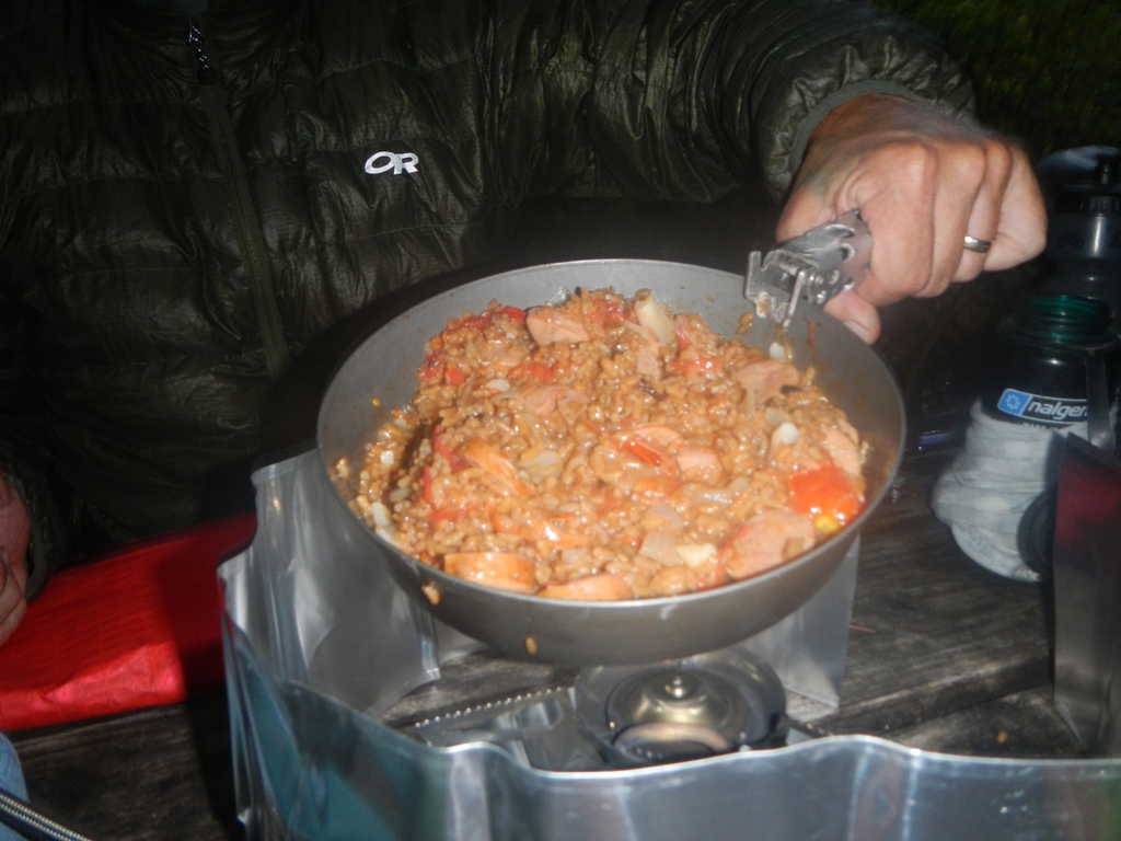
A hot dinner solves many ills
Ready for bed
Saturday, September 7th – 53 miles today/77 miles total
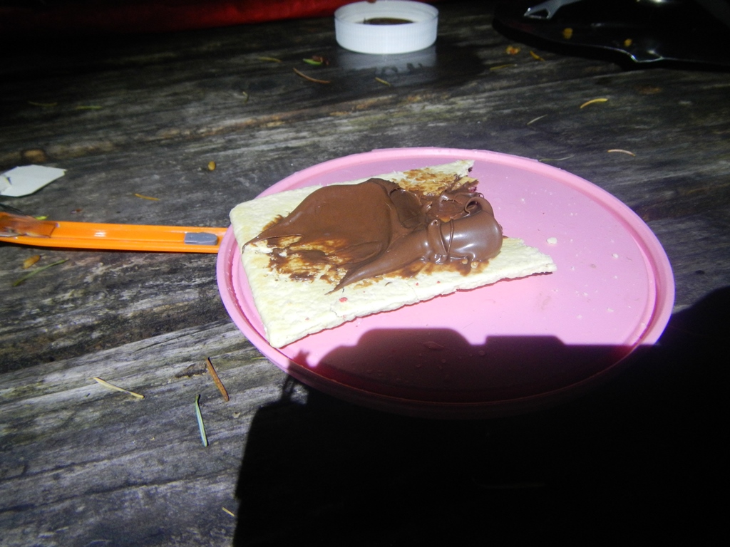
Move over Wheaties – Pop Tarts and Nutella!

Blueberries and Nutella on a baguette
With breakfast eaten, camp broken, bikes loaded and water bottles filled, it was time to go. How was it 10 am already? Really? I wonder how far we’ll get today. We would start with a four mile, 1200 foot climb, followed by 32 miles of mostly downhill to Westfir.
Aufderheide Memorial Rd
We started by riding up along the sort of aptly named Roaring River. While it was most definitely roaring, it didn’t seem bigger than the many creeks we road along. Turning a bend in the road, we then followed McCabe Creek even higher until we leveled out on the pass.

Along the pass
Along the pass, there was a log cabin replica of the Box Canyon Guard Station as well as information signs about Robert Aufderheide and spotted owls. The initial southbound downhill drop from the pass, nearly 800 feet in two miles, is quite a rush, especially on a loaded touring bike. A fast right hand turn leads to another two to three miles of easy coasting down.
This fork of that fork…forkin’ confused
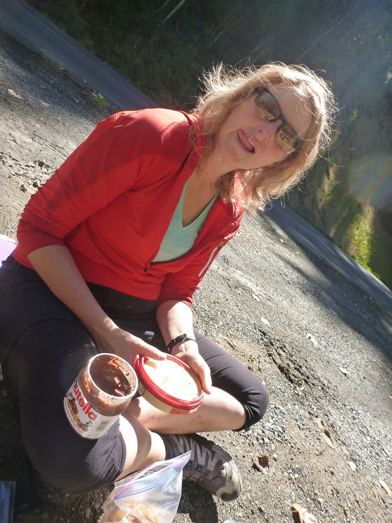
Humus or Nutella for a snack???
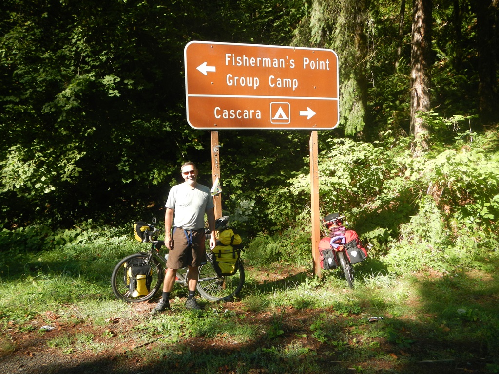
The next 25+ miles is a very pleasant, easy pedaling downhill to the intersection known as Westfir. Arriving about 2:30 pm and finding the Westfir Lodge serving delicious food, we made the only reasonable decision…a bit plate of nachos and a cold beverage or two. The lodge was a wonderfully old building converted into it’s present service. It wouldn’t surprise me if we end up staying there in the future with mountain bikes in tow.

Our return route to the McKenzie River basin would be along NF 18 so we needed to follow the Middle Fork of the Willamette River downstream another 25 miles or so before heading back over the mountains.

Cruisin’ away from Westfir
While the obvious route would be to ride Hwy 58 and then cross the river into Lowell, a bit of map work showed an alternate road along the north shore of the river all the way into town. As we approached our intended road, we met a local man, Phil, who had walked and ridden the area for decades. He was returning home and gave us some great local info about the gravel road between Westfir and Lowell and camping options along it. Thanks Phil!
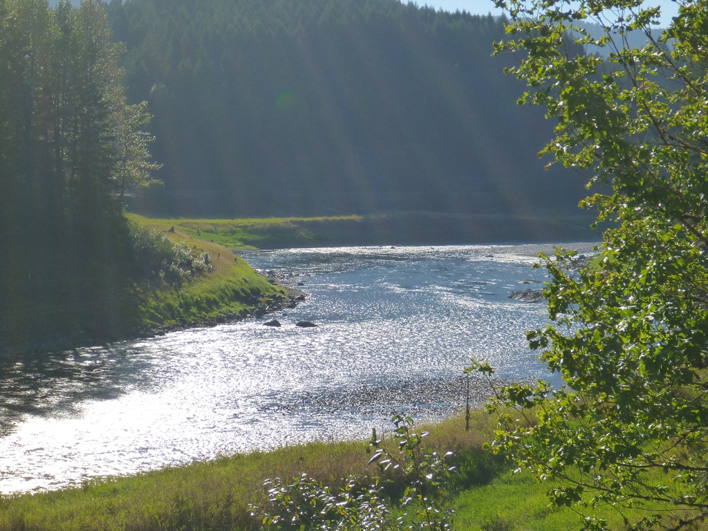
Middle Fork of the Willamette River
Continuing along N. Shore Dr/W. Boundary Rd, we began looking for a side road for a good wild camp with some water access. The Middle Fork of the Willamette is controlled by two dams separated by about two miles. The upstream dam, Lookout Point, creates a 10 mile long reservoir with numerous side roads. As the light began to drop, we found a decent spur with easy access to water. The weather was perfect so we slept out under the stars.
Middle Fork of the Willamette River before the dam stops the flow completely
Sunday, September 8th – 62 miles today/139 miles total
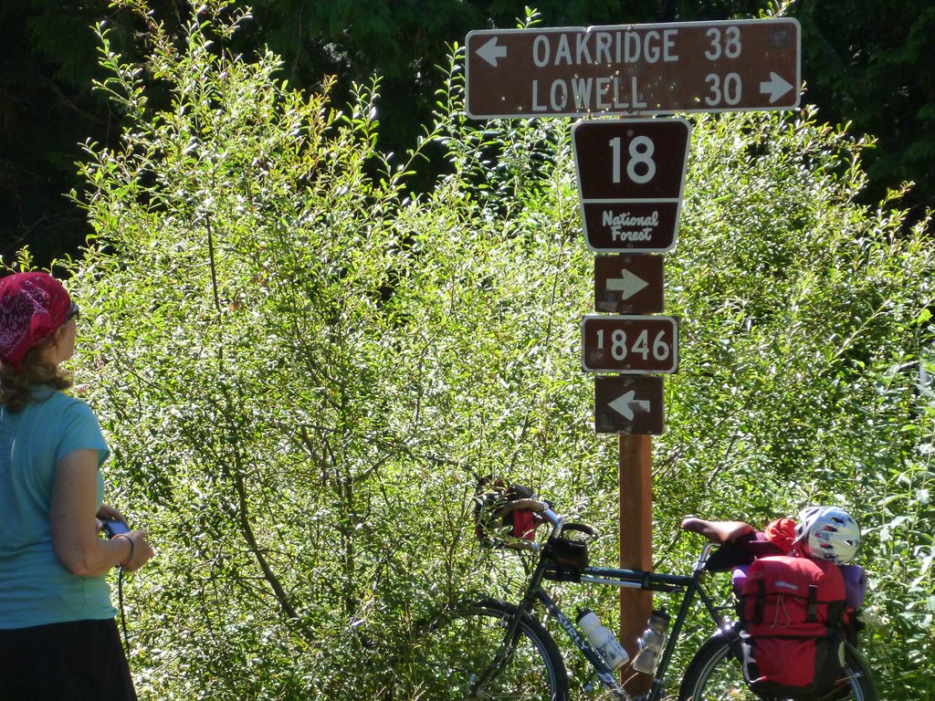
Today would be catch-up day. Janet needs to teach Monday morning so we have no choice but to make up those extra 20 miles from Friday. This shouldn’t be too difficult but it does mean an extra 20 miles in our legs before we tackle the final steep, gravel miles leading to the crest on NF 18.

Lookout Point Dam

Amazingly it was Jay that was up and about just before sunrise. It does happen, but only based on the Mayan calendar…After a quick breakfast, the bikes are packed and rolling by 7:30 am. The plan is to ride into Lowell 10 miles away, stop at a cafe and get a hearty, second breakfast. As it turns out, Lowell is a little town in a lovely location but it appears to be nearly closed.

Stylish cycle wear
In fact, we can’t even find a cafe at all, open or closed. Only the gas station/mini market is open so Janet comes back outside with the healthiest load of cycling calories possible…breakfast burritos made fresh! This is supplemented by mega-vitamin overload superfood drinks from Odwalla. Wow! Over 500% of my daily requirement of 6 B vitamins. That’s impressive, too bad I’ll just pee much of it out later. I wonder what color my urine will be?
Fall Creek
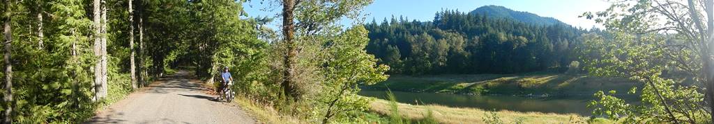
Another beautiful late summer Oregon day in another beautiful Oregon location. After our burrito bonanza (they really were fresh and tasty!), we rode out of Lowell towards the north shore of Fall Creek Lake. We’ll be riding along Big Fall Creek Rd (NF18) until it crests so navigation wouldn’t be an issue today. This morning there was a wonderful lack of traffic. It seems as though the lake must be closed to boaters already as we saw only three or four cars all morning and nothing on the lake.

As we crossed the bridge over Fall Creek at the eastern boundary of the lake, we took a stretch break. We’d ridden nearly 20 miles so far and were nearly to where we expected to have camped. Since it was just after 10 am and many of our touring mornings seem to begin about that time, we seem to be caught up and should be right on schedule..albeit with an extra few warm-up miles already. From here it is 20 miles of climbing, 16 miles down and finally eight to nine miles along the McKenzie River back to Rainbow.

Lovely morning for a ride
The first 13 miles or so climbing along Fall Creek were absolutely wonderful. The morning remained fairly cool, we had bright blue skies filtered through a heavy canopy of trees and the paved road was nearly traffic free. There were a number of small campsites spread out along the way with a family or two at each one. This may, in fact, give Janet another option to teach her beginning backpacking course. At one creek crossing we took a long snack and water break while sitting on the bridge. The last remnants of Thursday’s baguette, cream cheese and blueberries were finally gone.

JP still crusin’
As we knew it would, the pavement ended and the gravel road turned ever steeply upward. We’d spent the morning climbing in the middle ring but we quickly reached for our smaller gears. The first mile or two of gravel were very manageable but, as the road continued to steepen, we found ourselves in the granny gear and barely able to maintain more than a walking speed.
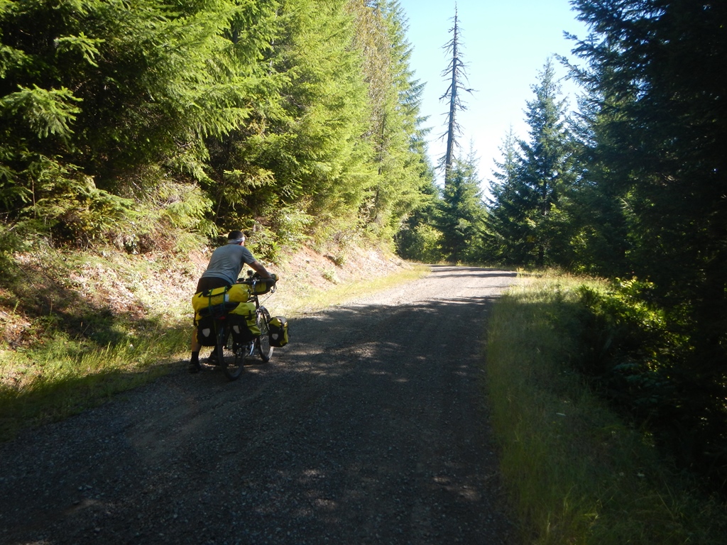
Jay using those “other” muscles to walk the final mile
About three miles from the crest, Jay discovered that finishing the cream cheese, bought on Thursday but not refrigerated since Friday morning, wasn’t the best idea. His GI system was beginning to revolt, nausea was setting in and his energy level dropped to just enough to stay upright. Some how he managed to ride to within a mile of the crest before getting off the bike and pushing. Although increasingly difficult and getting wobbly, Janet continued pedaling, but only at the same speed as Jay was walking. Finally, with less than half a mile to go, Janet succumbed to the grade and we crested on foot, together.
JP at the crossroads. Should we go back to Oakridge and do it all again? Not today!
With unloaded mountain bikes, this would have been a strenuous but great ride. With fully loaded bikes, it was still a strenuous and great ride but a bit more than we had in us today. To us, it’s all part of the adventure. We took a good, long break at the top. Jay was able to eat a few bites of a Clif Bar and drink some water as the nausea began to recede. Janet was ready for the downhill.

Jay feeling better, but not good
Prior to leaving on this trip, Janet’s stock 26 x 1.6 tires were replaced by new Schwalbe Marathon Mondials, 26 x 2.0. These are more similar to the mountain bike tires she was accustomed to and now she’d get a chance to try them out on a long, dirt and gravel downhill. She had expressed a lack of confidence in the stock tires when off road and these tires should be just the right combination of smooth enough on pavement and grippy enough off road…it’s time to find out!
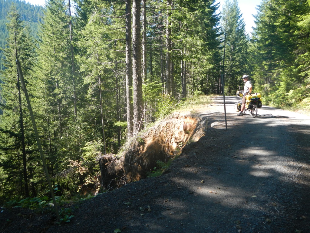
Taking a break on the way down. The hillside below had washed out
The upper few miles down were steep but the surface was fairly smooth gravel and dirt. The only real potential problem would be a vehicle coming up the hill not expecting cyclists bombing down. Since we were loaded down, we rode conservatively, stopping a few times to rest our braking muscles and allow our rims to cool…yes it was that steep! Janet felt right at home using these new tires as well – no slipping or skidding, lots of traction!
We continued in this fashion for just over five miles, or so, dropping about 1600 feet. Things changed when we crossed from the national forest land to privately held timber property. The final 11 miles of downhill were covered with varying sizes of gravel from small and easy to roll over to nearly impassable rocks in between road width pot holes. This 11 miles of rough and tumble downhill had us wishing for a bit of climbing as relief.
Finally we came out of the backcountry at Quinn Creek Rd and Hwy 126. All that was left was an easy nine mile highway ride upriver along the McKenzie. Highway 126 has a nice and wide shoulder and many cyclists use this route while in the early stages of their trans-america route. Once back at Harbick’s, fresh apples, iced tea and a quick change of clothes got us back on the road home…another successful trip, no flats, no mechanical issues, nothing forgotten or lost.
Enjoy the ride,
Janet and Jay
